The image above is the transportation reserve that comes from the HRM website here:
As indicated in my last council post (Item 10.1), writing about Robie has been on my mind for some time:
Widening Robie Street to accommodate Bus Rapid Transit (BRT) and later Light Rail Transit (LRT) from Young Street to Inglis Street
Here’s the HRM page on the topic:
Transit Priority on Robie and Young streets | Halifax
Thank you to everyone who has shared your shared your thoughts and feelings with council or me specifically on this topic.
Do I love the idea of paving more land, increasing the pedestrian crossing distance, demolishing buildings and removing mature trees? No, of course not.
Would I prefer to reallocate road space to provide dedicated bus lanes? Yes.
Do I think proceeding with the project at this point is the right thing to do. Yes.
Councillor Hinch made a motion at budget committee last month to stop funding this project. The motion failed 3 (Yes) – 14 (No). I seconded the motion and explained my “No” vote and project reservations in the video below.
See my remarks at 4 hr : 57 mins, the debate starts at 4 hr: 50 mins: 43 sec.
February 20, 2026 Budget Committee Continuation
Here’s more detail in writing on why I voted to proceed with the project at this time:
The Robie Street transportation reserve (the land to acquire) was approved by council in 2021.
There is no similar map for the portions south of Cunard down to Inglis.
Staff: “Potential land needs for that section have not been established in detail but are expected to be significantly less than for the section north of Cunard Street. This will be confirmed through the next stages of design for that section.”
This plan for Robie Street has been in motion since 2019 with the changes to zoning explained below. It has current council and provincial support. The land in the transportation reserve is nearly all purchased.
I did ask (verbally) about doing 1-way general traffic on Windsor and 1-way on Robie to avoid the widening from three four lanes last year, but that got a no-go from staff (page 11).
Zoning
Between the Centre Plan and Halifax Accelerator Fund (HAF) zoning changes between 2019 and 2024, most of the land along Robie from Young to Spring Garden/College Street area has been upzoned to Centre (CEN-2) & Corridor (COR) zones. (The Esso/Coast Tire area is zoned Comprehensive Development District 2, CDD-2).
South of Spring Garden Road/College Street area most of the land along Robie is zoned Established Residential 3 (ER-3) or ER-2, with some University College 1 (UC-1), UC-2, Institutional (INS) and Higher Order Residential 1 (HR-1).
lub_rc_sch2-zoningboundaries_13march2026.pdf
What this means is, eventually the buildings that line the narrowest part of Robie (between Almon and Cunard), will be demolished and the land will be developed into taller structures someday, whether the extra lane for transit is added or not. Changing the zoning again to match the buildings that now exist is extremely unlikely.
Trees
Because this land has been upzoned, the trees also face development pressure. We can see that some of them are already at end of life in the transportation reserve.
Staff: “When a public tree extends onto or over private property, as many of the mature trees on Robie street do, we are limited in our ability to intervene due to private property rights.
…we don’t expect that that we would be able to protect many of these trees as the area redevelops and densifies, which is occurring or anticipated to occur in the near future.”
“… those (new trees) planned for Robie Street are being established under conditions that will support their establishment and growth in a challenging urban environment. These conditions will also ensure protection during future redevelopment…. the offsets provided will help maintain a mature tree canopy along Robie Street in the future.”
Housing
We will end up with more housing in this area than is being lost. Yes, the most affordable housing is the stock that already exists. Yes, it is more sustainable from an embodied carbon perspective to preserve buildings, but as stated above, these buildings are not going to be here long term. I do not know what will be built here, but much of the land has been purchased by the province, so there is a possibility that affordable homes may be provided.
The more people that we have living in the Regional Centre, the fewer commuters we will have driving in. This benefits both the people that need/want to drive in, and the people that live here in limiting or decreasing the general traffic in our neighbourhoods. There are huge environmental and economic costs to sprawl, so this is why we are adding density to the urban core. Welcoming more people adds vibrancy to the peninsula and helps all of HRM thrive. (This concept applies to all of the complete communities envisioned in the Regional Plan – live, work, shop & play closer to home.)
Transit
It is important to remember that this widening project is to add space for transit: first curbside bus lanes, later median bus lanes, then median LRT as the decades pass. We need higher order transit in HRM. We simply cannot grow and maintain our dependance on personal vehicles for most trips. BRT/LRT and fast ferries are the plan for HRM, and as these come online, our conventional bus service will be adjusted to best interact with these new services.
No extra space is planned to be added for general traffic on Robie. I do think that we could decrease the planned space allocated to general traffic over time, because many of the personal vehicle trips will be replaced by the transit service we are building.
Jurisdiction
Here’s the provincial perspective on transportation. We are a creature of the province, meaning they have legislative authority over HRM.
Moving Forward
My current thoughts on this project are to encourage keeping the number of travel lanes along Robie to four as design phases progress, because in some places six lanes were recommended in 2019 (two for transit, four for general traffic). I don’t believe there is a need for two lanes in each direction for general traffic, as we will be providing a new service that currently does not exist (fast, frequent, reliable transit).
I would like to do this to save construction and maintenance costs, and most importantly to decrease the conflicts between drivers and active transportation users/pedestrians. If we are going to have more people living and walking/rolling along Robie, we need to make it a pleasant place to be, not a thoroughfare.
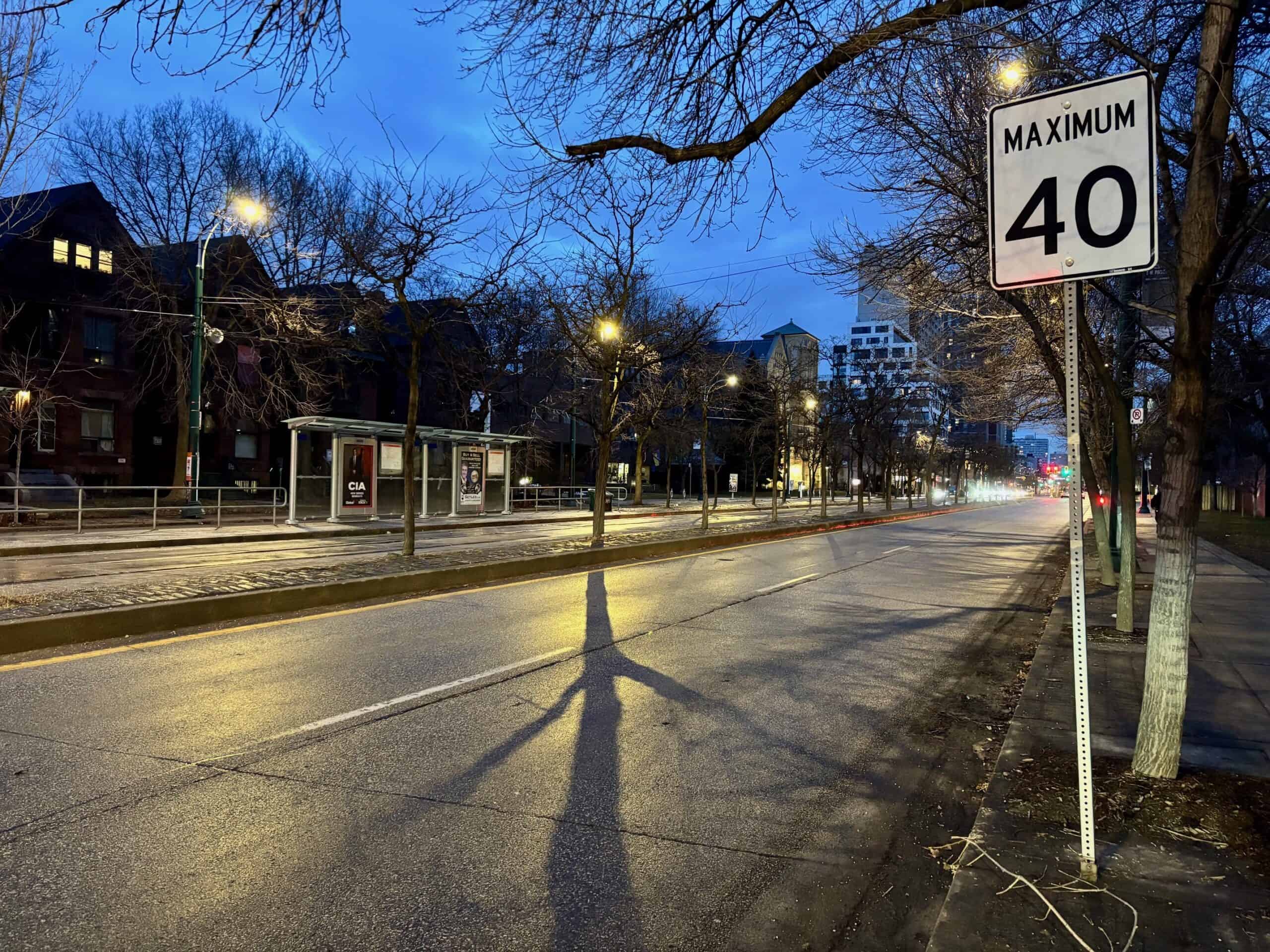
I was in Toronto for March break and noted that all urban streets are maximum 40 kph, and many are 30 kph. I’d like to keep the width allocated to private vehicles and transit as narrow as possible on Robie to encourage safe speeds and use any extra space we have for active transportation. What is built on Robie will change over time, but having the Right of Way (ROW) land available for the public allows for future decision makers to implement LRT.

My fears: the current or future dedicated transit lanes will become HOV, or worse, general traffic lanes. 10 February 2026 HRM Council Meeting: Personal Vehicles in Bus Lanes, AAA Bicycle Network Alternatives, MDFs
The major downside of future median BRT/LRT lanes would be the loss of mature trees in the south end, especially in the Gorsebrook Park block where they are the grandest.
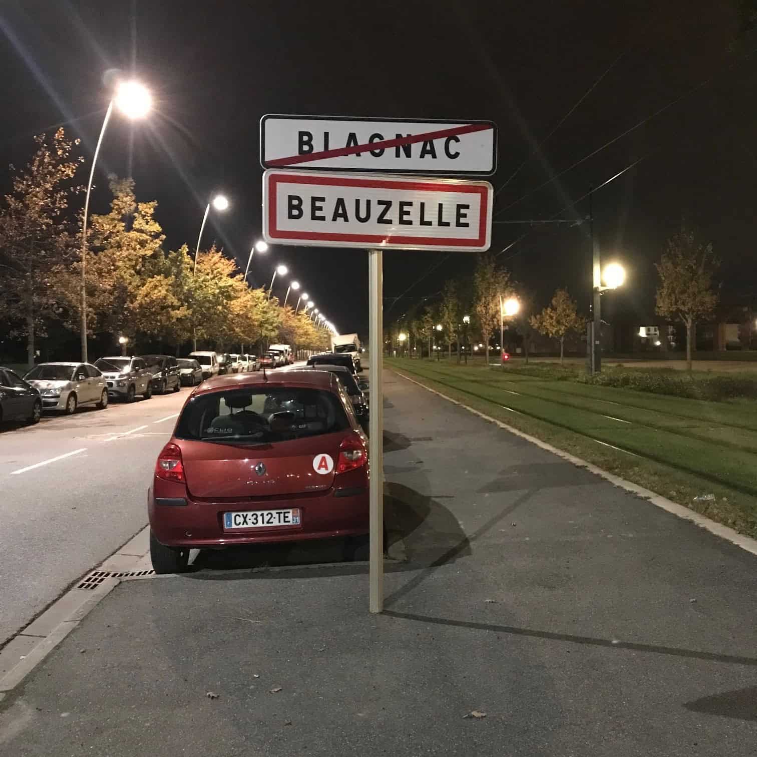
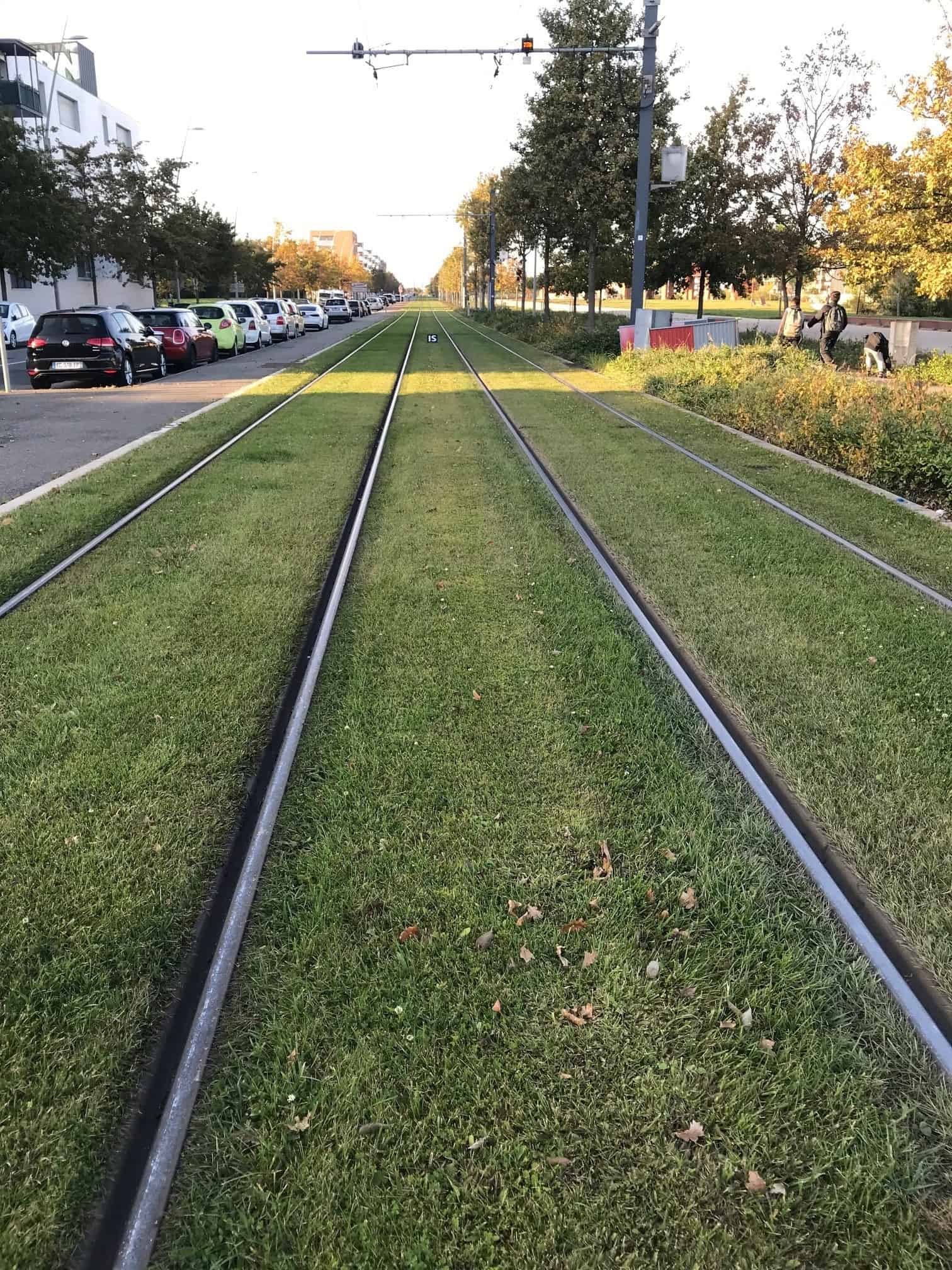
My hopes: Robie Street will be improved to move more people and goods, while becoming a more pleasant space to be outside of a vehicle than it currently is. These pics aren’t great, but something like this (Toulouse, France, November 2021). Space for transit, space for driving and space for walking along the edges and in the middle (I don’t think we should have much parking to keep the width to a minimum.)

This council has not yet voted on design of any sections; the last council approval of concepts was in July 2019.
Transit Priority Corridors – Robie Street / Young Street – July 16/19 Regional Council | Halifax.ca
Staff: “A staff report for Robie that focuses primarily on the northern segment (Robie – Cunard to Young, Young – Robie to Windsor) is targeted April TSC. That report will provide an update on the design status and answer some questions that Council had asked about the project last year related to design options and transit time savings.”
So, we will get to see what the latest plan is and respond soon.
The south section (Cunard to Inglis) is supposed to be going out early spring 2026 as a contract to be designed to 60% design phase. I don’t know when this will then end up at council.